
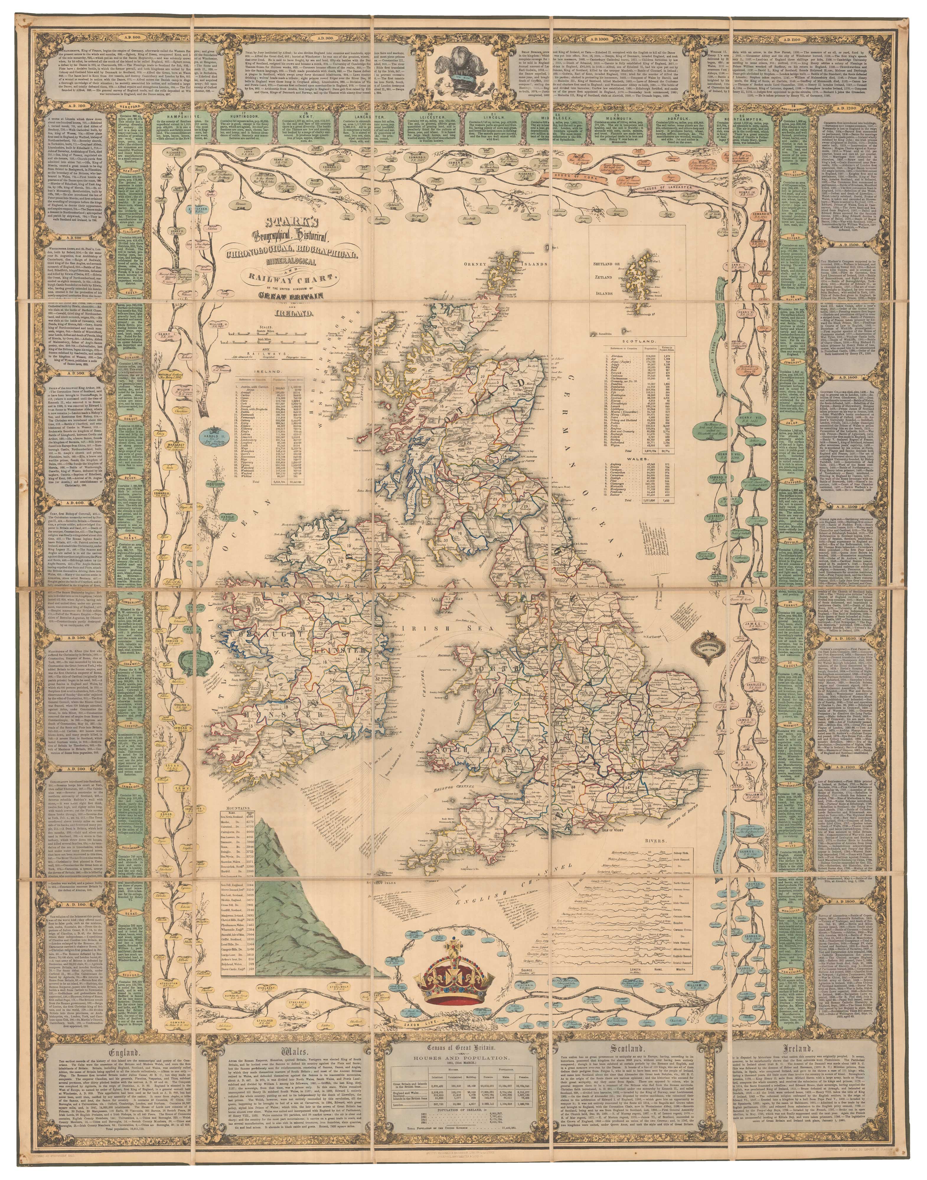
A Victorian educational map of the British Isles
STARK, J.
Stark's Geographical, Historical, Chronological, Biographical, Mineralogical and Railway Chart of the United Kingdom of Great Britain and Ireland.
Glasgow: J. Stark, 1851. Lithographic map with original hand colour. Dissected and laid on linen, total 1020 x 795mm, folded into the original covers.
A large map of the British Isles, surrounded by a very decorative border filled with panels of text, including important events, descriptions of the home countries and the counties of England. Just inside the border are the branches of a family tree of the British monarchy, starting with the Saxon kings and ending with the children of Queen Victoria, and tables of mountain heights and river lengths. Two vignettes depict the queen's crown and the Prince of Wales's feathers.
Stock ID : 24080
£1,700
£1,700


Altea Antique Maps & Charts
Altea Gallery Ltd, 35 St George Street
London
W1S 2FN
United Kingdom
Tel: +44 20 7491 0010
info@alteagallery.com
Sitemap :

