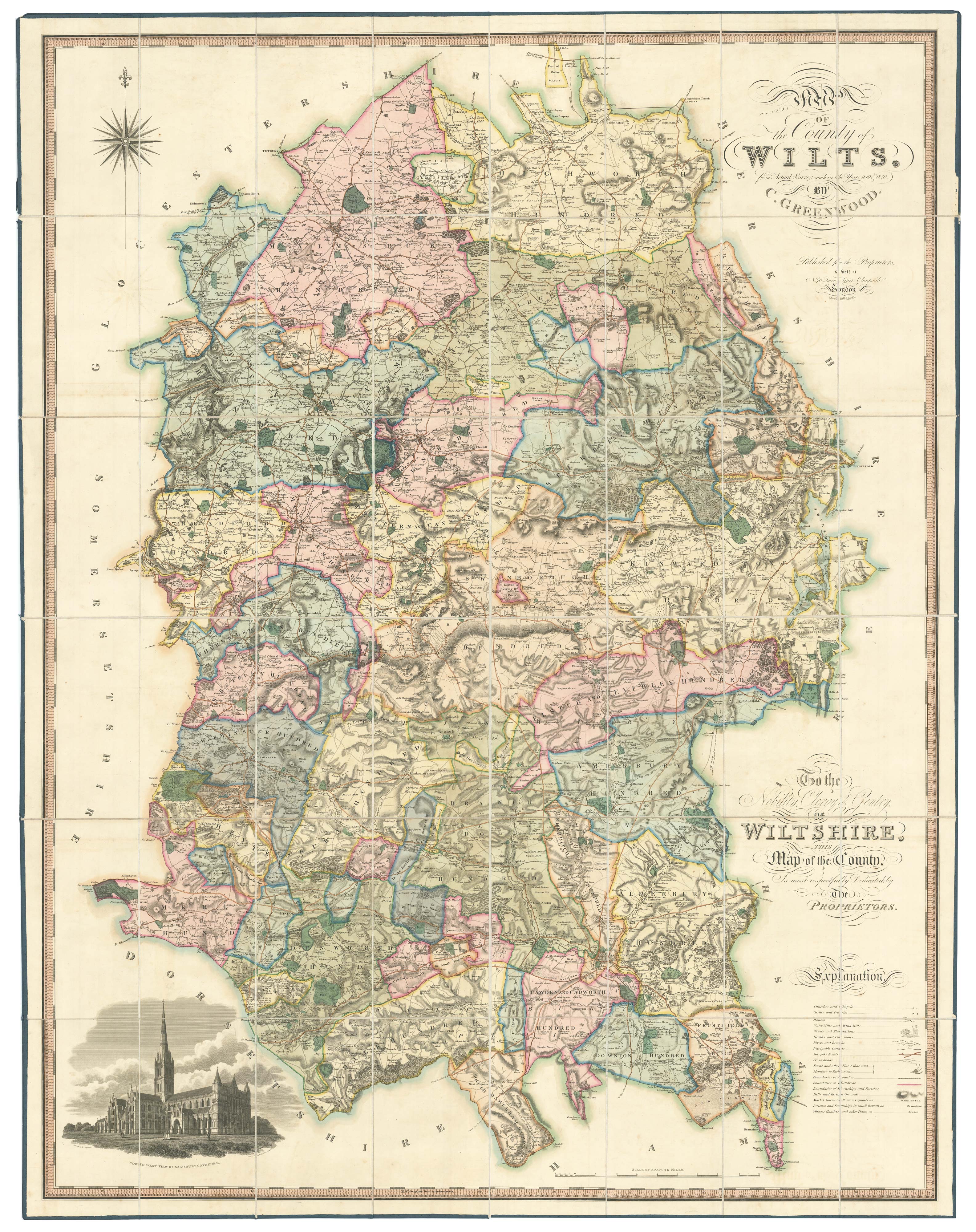


A large scale map of Wiltshire in fine hand colour
Map of the County of Wilts, from Actual Survey, made in the Years 1819 & 1820 by C. & J. Greenwood.
London, Christopher Greenwood & George Pringle senior & junior, 1820. Fine original colour. Four sheets conjoined, dissected and laid on linen. as issued, total 1445 x 1115mm, folded into the original full calf case with a maroon morocco gilt title label.
£2,250.00
1 in stock
x
Question About This Item?
A large scale map of Wiltshire in fine hand colour & GREENWOOD, Christopher.Stock #: 26609"*" indicates required fields
Similar to Sell?
Add to Wishlist
Add to Wishlist
Description
A very fine example of this large and detailed map of Wiltshire, on a scale of an inch to a mile. It is decorated with a large compass rose and a vignette of Salisbury Cathedral.
It was engraved by Samuel John Neele for a series of such maps surveyed by Christopher Greenwood, joined later by his brother John, begun in 1818 and ended in 1834. Six counties were not included, probably because similar maps of those had already been made by Andrew Bryant, as well as competition from the government-backed Ordnance Survey.
Condition:
Slight rubbing of case.Related products
Items by the same author
Add to Wishlist
Add to Wishlist