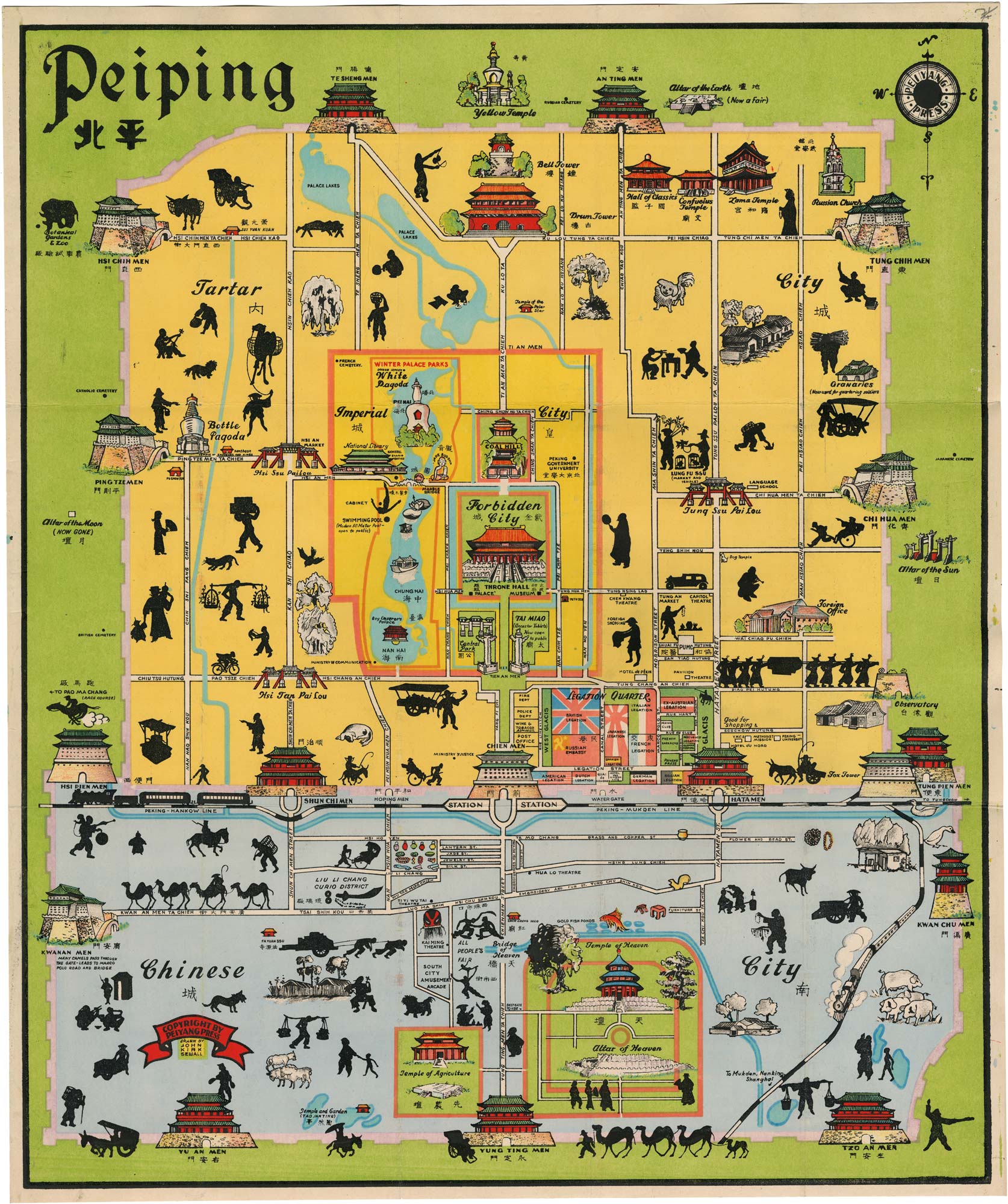


A pictorial map of Beijing in the early 1930s
Peiping.
Beijing: Peiying Press. c.1935. Original colour ( lithographic map ). Sheet 595 x 500mm.
£1,500.00
1 in stock
x
Question About This Item?
A pictorial map of Beijing in the early 1930s & SEWALL, John Kirk.Stock #: 26428"*" indicates required fields
Similar to Sell?
Add to Wishlist
Add to Wishlist
Description
A pictorial street map of the inner city of Beijing, showing the three parts of the city (the Tartar City, the Imperial City (which contains the Forbidden City) and the Chinese City) with illustrations of major buildings, monuments and train stations. Illustrations include black silhouettes of workers, pedestrians and animals, including camel trains.
We have dated the map, which is labeled in English and Chinese, because of the black, white and red flag of the German Reich (1933-35), prior to the introduction of the red flag with the swastika.