
Antique Maps by HORWOOD, Richard.
Richard Horwood (c.1758–1803) was an English surveyor and cartographer, best known for producing one of the most detailed large-scale maps of Georgian London. His work matters for its close, street-by-street depiction of the rapidly expanding metropolis at the end of the eighteenth century, and for the way it set a new benchmark for urban surveying in Britain.
Horwood’s principal achievement is his Plan of the Cities of London and Westminster, the Borough of Southwark, and Parts Adjacent, issued at the close of the 1790s. Compiled from systematic survey work and published on multiple sheets, the plan records streets, courts and building footprints with a level of precision that made it invaluable both to contemporaries and to later historians of London’s topography and development.
Although later maps would revise and extend his coverage, Horwood’s London plan remains a cornerstone of English city cartography, capturing the capital at a moment of profound change in its fabric and governance.
→ Explore more works by Richard Horwood

Mayfair & Marylebone from an important large-scale survey of London
HORWOOD, Richard. Date: 1813 Stock #: 26372 £2,800.00![[Untitled plan of Pimlico and Belgravia.] B. 4. by HORWOOD, Richard., 1799.](https://altea-gallery-cdn.s3.eu-west-2.amazonaws.com/wp-content/uploads/2025/05/17115327/alteashop_24400.jpg)
Pimlico and Belgravia from an important large-scale survey of London
HORWOOD, Richard. Date: 1799 Stock #: 24400 £700.00![[Knightsbridge.] A. 3. by HORWOOD, Richard., 1794.](https://altea-gallery-cdn.s3.eu-west-2.amazonaws.com/wp-content/uploads/2025/05/17115331/alteashop_24401.jpg)
Knightsbridge from an important large-scale survey of London
HORWOOD, Richard. Date: 1794 Stock #: 24401 £1,500.00![[St James's.] B. 3. by HORWOOD, Richard., 1795.](https://altea-gallery-cdn.s3.eu-west-2.amazonaws.com/wp-content/uploads/2025/05/17115335/alteashop_24402.jpg)
St James's from an important large-scale survey of London
HORWOOD, Richard. Date: 1795 Stock #: 24402 £1,500.00![[Chelsea.] A. 4. by HORWOOD, Richard., 1799.](https://altea-gallery-cdn.s3.eu-west-2.amazonaws.com/wp-content/uploads/2025/05/17115338/alteashop_24403.jpg)
Chelsea from an important large-scale survey of London
HORWOOD, Richard. Date: 1799 Stock #: 24403 £1,500.00![[Fitzrovia .] by HORWOOD, Richard., 1794.](https://altea-gallery-cdn.s3.eu-west-2.amazonaws.com/wp-content/uploads/2025/05/10124350/alteashop_20824.jpg)
A detailed plan of Fitzrovia at the end of the 18th century
HORWOOD, Richard. Date: 1794 Stock #: 20824 £500.00![[The City and Whitechapel.] by HORWOOD, Richard., 1799.](https://altea-gallery-cdn.s3.eu-west-2.amazonaws.com/wp-content/uploads/2025/05/08145409/alteashop_18463.jpg)
The City and Whitechapel from an important large-scale survey of London
HORWOOD, Richard. Date: 1799 Stock #: 18463 £1,250.00![A detailed plan of Fitzrovia with a view of the 'New Road' - [Fitzrovia .] by HORWOOD, Richard., 1794 – Altea Gallery](https://altea-gallery-cdn.s3.eu-west-2.amazonaws.com/wp-content/uploads/2025/05/08131101/alteashop_16924.jpg)
A detailed plan of Fitzrovia with a view of the 'New Road'
HORWOOD, Richard. Date: 1794 Stock #: 16924 £750.00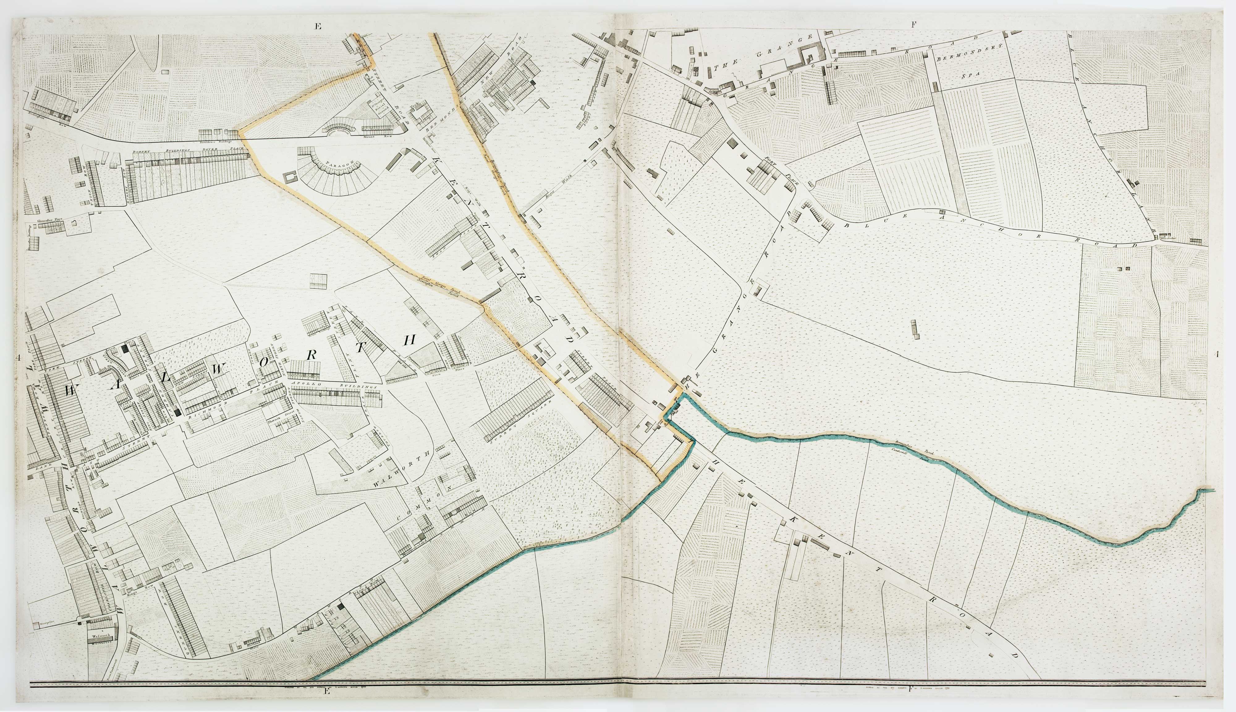
Walworth from an important large-scale survey of London
HORWOOD, Richard. Date: 1799 Stock #: 12672 £550.00![Westminster and Lambeth from an important large-scale survey of London - [Westminster & Lambeth.] by HORWOOD, Richard., 1799 – Altea Gallery](https://altea-gallery-cdn.s3.eu-west-2.amazonaws.com/wp-content/uploads/2025/04/29153617/alteashop_12670.jpg)
Westminster and Lambeth from an important large-scale survey of London
HORWOOD, Richard. Date: 1799 Stock #: 12670 £1,100.00![Marylebone & St Pancras from an important large-scale survey of London - [Marylebone & St Pancras.] by HORWOOD, Richard., 1799 – Altea Gallery](https://altea-gallery-cdn.s3.eu-west-2.amazonaws.com/wp-content/uploads/2025/04/29153612/alteashop_12668.jpg)