
Antique Maps by VARTHEMA, Ludovico di.
Ludovico di Varthema (c.1470–1517), an Italian traveller and early writer of geographical description, matters to the history of cartography for the practical, first-hand information his journeys supplied to European readers at the opening of the sixteenth century. Although not a mapmaker in the strict sense, his accounts helped shape contemporary conceptions of the eastern Mediterranean, the Middle East, India and Island South-East Asia at a moment when printed cosmographies and maps were rapidly absorbing new intelligence.
Varthema travelled widely, including through the Levant and Arabia, and went on to India and beyond, recording routes, distances, ports and commercial networks with an attention to observed detail that made his narrative unusually useful to compilers. His principal work, commonly known in English as the Itinerary (first printed in 1510), circulated in multiple editions and translations and became a notable source for later geographical writers and, indirectly, for map publishers seeking to update place-names and regional descriptions.
His importance for collectors often lies in the way Varthema’s text intersects with early printed geography: it sits at the threshold between medieval travel literature and the more systematic chorographies and maps of the Renaissance.
→ Explore more works by Ludovico di Varthema
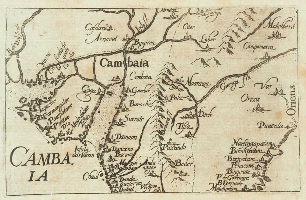
Map of Northern India from Varthema's Travels
VARTHEMA, Ludovico di. Date: 1610 Stock #: 13207 £320.00