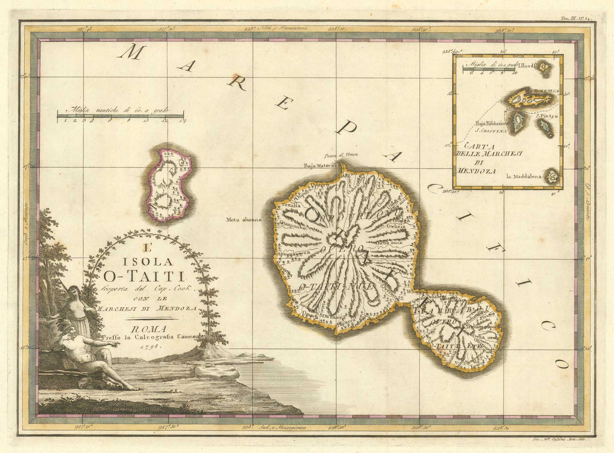


Captain Cook’s mapping of Tahiti
L'Isola O-Tahiti scoperta dal Cap. Cook, Con le Marchesi di Mendoza.
Rome, 1798. Original colour. 375 x 550mm.
£400.00
1 in stock
x
Question About This Item?
Captain Cook’s mapping of Tahiti & CASSINI, Giovanni Maria.Stock #: 15546"*" indicates required fields
Similar to Sell?
Add to Wishlist
Add to Wishlist
Description
Published in the scarce atlas, the 'Nuovo atlante geografico universale', this map is one of the most decorative maps of Tahiti.
Cook's mission on his First Voyage to the South Seas was to observe the transit of Venus across the Sun in 1769, at the request of the Royal Society. During the three months he stayed on the island he sailed round it in a small boat, a trip which resulted in this map. To the north can be seen 'Point Venus'. An inset show the Marquesas Islands.
Condition:
A good example.Related products
-

The Tahitians attack the ‘Dolphin’
ROOKER, E. Date: 1773Stock #: 13809 £160.00 -

17th century miniature map of the Solomon Islands joined to New Zealand
MALLET, Alain Manesson. Date: 1683Stock #: 19096 £150.00 -

An early map of Guam
NOORT, Olivier van. Date: 1646Stock #: 25508 £220.00 -

Raiatea Island from Cook’s Voyages
HAWKESWORTH, John. Date: 1773Stock #: 13815 £220.00 -

Samuel Wallis meets Oberea, the female chieftain of Tahiti
HAWKESWORTH, John. Date: 1773Stock #: 13808 £90.00

Items by the same author
Add to Wishlist
Add to Wishlist
Add to Wishlist
Add to Wishlist

Add to Wishlist
Add to Wishlist
Add to Wishlist
Add to Wishlist
Add to Wishlist
Add to Wishlist
Add to Wishlist
Add to Wishlist