

Map of the United Arab Republic
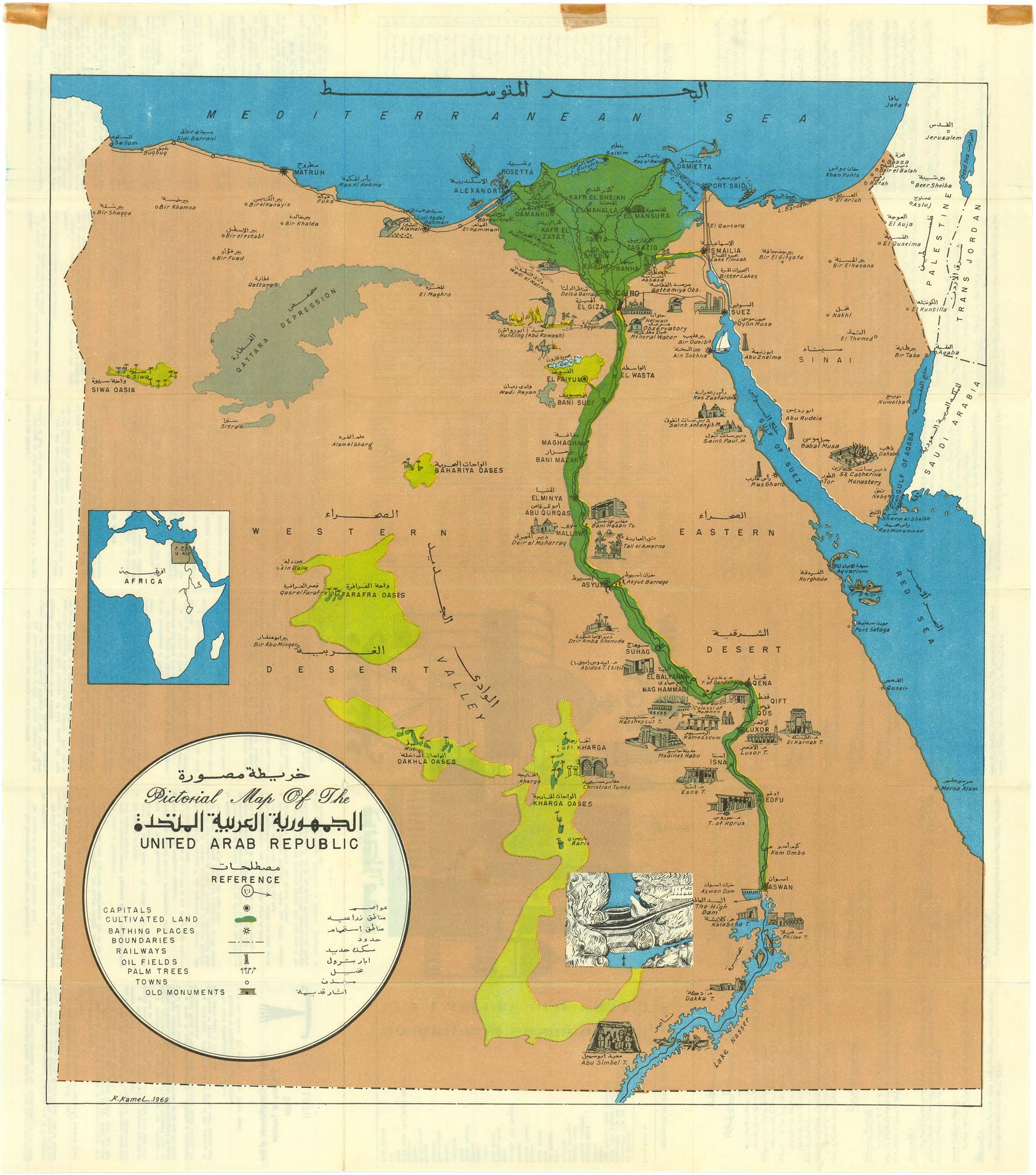
[Pictorial Map of the United Arab Republic] Kharitat Musawwarat al-Jumhuriya al-'Arabiya al-Muttahida / خريطة مصورة الجمهورية العربية المتحدة
Cairo,1970. Colour printed map. Sheet size 655mm x 585mm.
£450.00
1 in stock
x
Question About This Item?
Map of the United Arab Republic & KAMEL, KStock #: 25009"*" indicates required fields
Similar to Sell?
Add to Wishlist
Add to Wishlist
Description
Tourist map of Egypt during its brief period as the United Arab Republic, with the boundaries of Palestine, Jordan, and Saudi Arabia outlined.
The map has both English and Arabic translations as well as a detailed key highlighting infrastructure such as the newly constructed Aswan High Dam along the Nile and geography of the region.
The United Arab Republic was established on February 1, 1958, through a political union between Egypt and Syria, lasting until Syria's military coup in 1961. Egypt retained the name until 1971 when it became the United Republic of Egypt under President Gamal Abdel Nasser.
Condition:
Minor tears to folds. Tape marks to top margin.Related products
-

Ortelius’s map of Barbary in fine colour
ORTELIUS, Abraham. Date: 1603Stock #: 23807 £600.00 -

A rare plan of Djerba under siege by the Ottomans in 1551
LAFRERI, Antonio. Date: 1573Stock #: 25313 £1,500.00 -

Miniature map of Mauretania & the Sahara
DU VAL, Pierre. Date: 1682Stock #: 10828 £80.00 -

Early 17th century map of central Africa
HONDIUS, Jodocus. Date: 1608Stock #: 23220 £200.00 -

A mid-17th century map of north west Africa
SANSON, Nicolas. Date: 1655Stock #: 19737 £250.00 -

18th century English map of North Africa
MOLL, Herman. Date: 1732Stock #: 25869 £120.00 -

A rare 17th century chart of north west Africa
JACOBSZ LOOTSMAN, Theunisz. Date: 1653Stock #: 25788 £850.00 -

A scarce two-sheet map of the Turkish Empire
VISSCHER, Nicolas. Date: 1730Stock #: 25736 -

A 17th century map of North Africa decorated with dragons
JANSSON, Jan. Date: 1650Stock #: 26721 £385.00