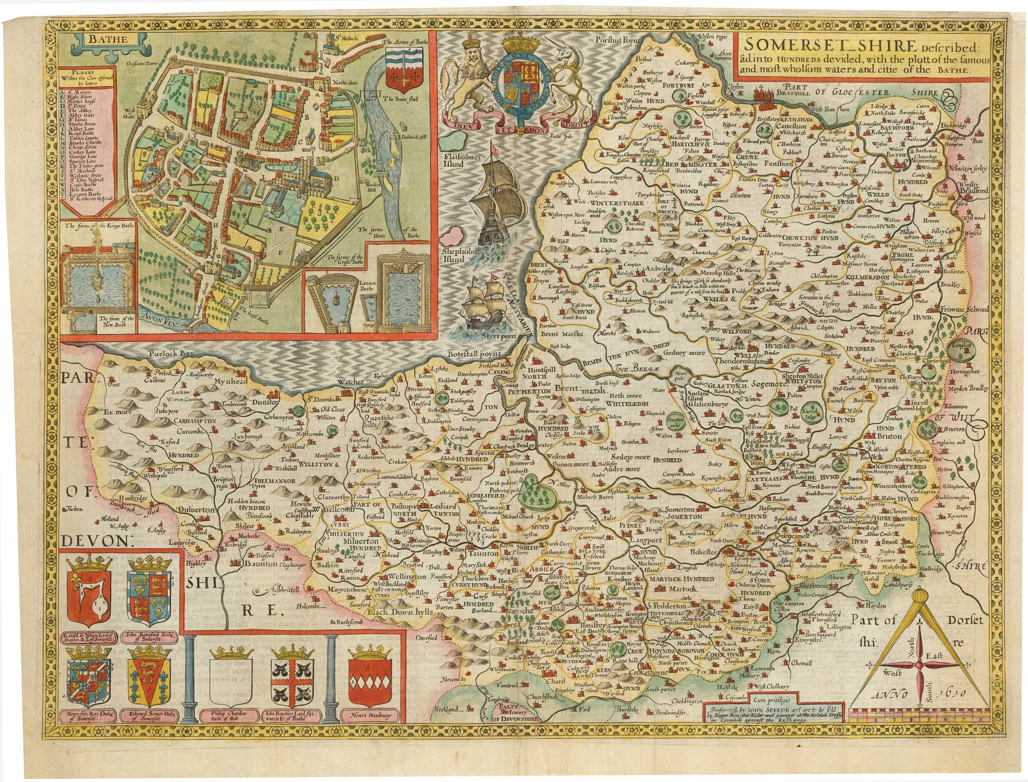


Early county map of Somerset
Somerset_Shire Described ãd into Hundreds devided, with the plott of the most famous and most wholsom waters and citie of the Bathe.
London: Roger Rea & Son, 1665. Coloured. 380 x 510mm.
x
Question About This Item?
Early county map of Somerset & SPEED, John.Stock #: 23967"*" indicates required fields
Similar to Sell?
Add to Wishlist
Add to Wishlist
Description
John Speed's early map of Somerset, engraved by Jodocus Hondius for Speed's county atlas, 'The Theatre of the Empire of Great Britain', first issued 1611-12. It is one of the most decorative maps of the county, with a plan of Bath with vignettes of the Roman baths, the Royal Arms and those of local nobles and a scale cartouche featuring a pair of compasses. On the reverse is a letterpress description of the county.
Tthis example comes from the Roger Rea issue, which was beset with disaster. According to an advert for the 1676 Bassett & Chiswell edition, ''the greatest part of an Impression, then newly Printed, [was] destroyed by the late dreadful Fire, 1666". Surviving examples of any Rea map are thus rare.
Condition:
Narrow top margin with repair to to right corner.Related products
Items by the same author
Add to Wishlist
Add to Wishlist
Add to Wishlist
Add to Wishlist
Add to Wishlist
Add to Wishlist

Add to Wishlist
Add to Wishlist
Add to Wishlist
Add to Wishlist

The first atlas map of the world to show California as an island
SPEED, John. Date: 1655 Stock #: 26500 £13,000.00
Add to Wishlist
Add to Wishlist